Albuquerque, New Mexico
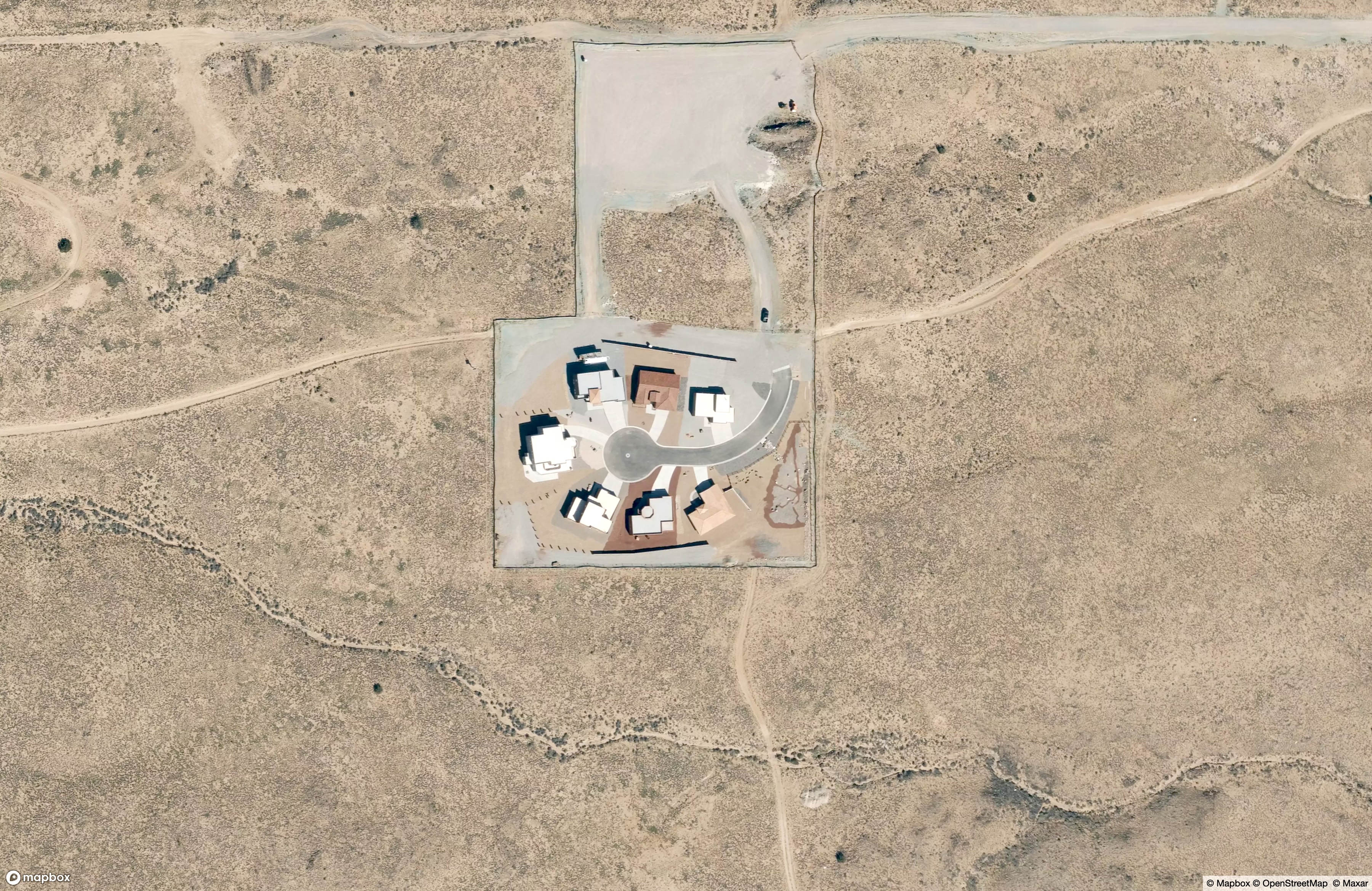
An abandoned planned community? A desert commune? Or the set of Vince Gilligan’s Pluribus, built whole-cloth just outside the limits of the city where he’s so far filmed Breaking Bad, Better Call Saul, and now this sci-fi-but-relatable series starring Rhea Seehorn? Yeah, it’s the last one.
Much of the show jet-sets around the world, literally, from a hillside in Morocco to a fairly terrifying hike through the Darien Gap in Panama. But it remains grounded in the main character’s sleepy cul-de-sac overlooking the Rio Grande and the Sandia Mountains. There are plenty of practical reasons why this block had to be cobbled together out in the desert, but it’s also fitting to reflect the isolation of Seehorn’s experience after an apocalypse-maybe. Highly recommended y’all watch this.
Yucca Flat, Nevada
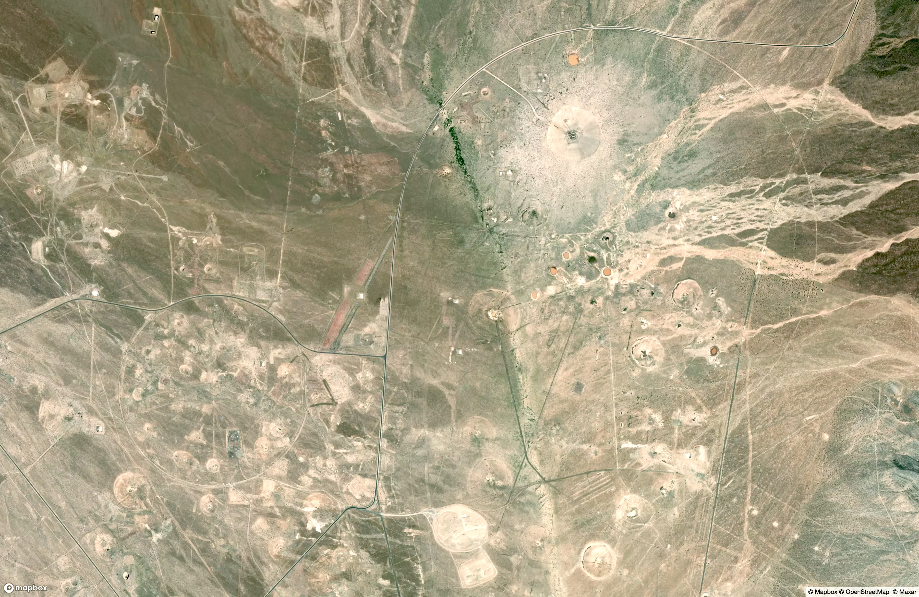
Area 51 - and all its mysteries - is just out of the frame here, over the ridge to the East. This, instead, is Area 10 of the Nevada National Security Site, pockmarked with some of the 928(!) live nuclear detonation tests that were conducted here between 1951 and 1992. Berms and roads are visible encircling some of the test craters, with implied precision and careful impact study, but the general chaos of the earth scars more suggests drunk teenagers with M-80s.
Pulling out some examples from decades of weapons development, this latter view is actually not too far off. Area 10 saw range tests of a bazooka-mounted tactical nuclear warhead called the “Davey Crockett” (“The weapon’s blast was not a danger to the crew as long as they followed normal procedures”). It hosted tests of air-to-air nuclear missles for shooting down strategic bombers (“Big boom take down big plane!”). And it was the site of ground impact studies where troops were marched around under live airbursts to test their mental fortitude, and incidentally to see if the radiation would dissipate before it landed on them.
The surface of Area 10 is now sufficiently decontaminated that monthly tours are open to the public. However, the legacy of testing remains in toxic aquifers and in elevated cancer rates among communities in Utah and further downwind.
Nassau, Cook Islands
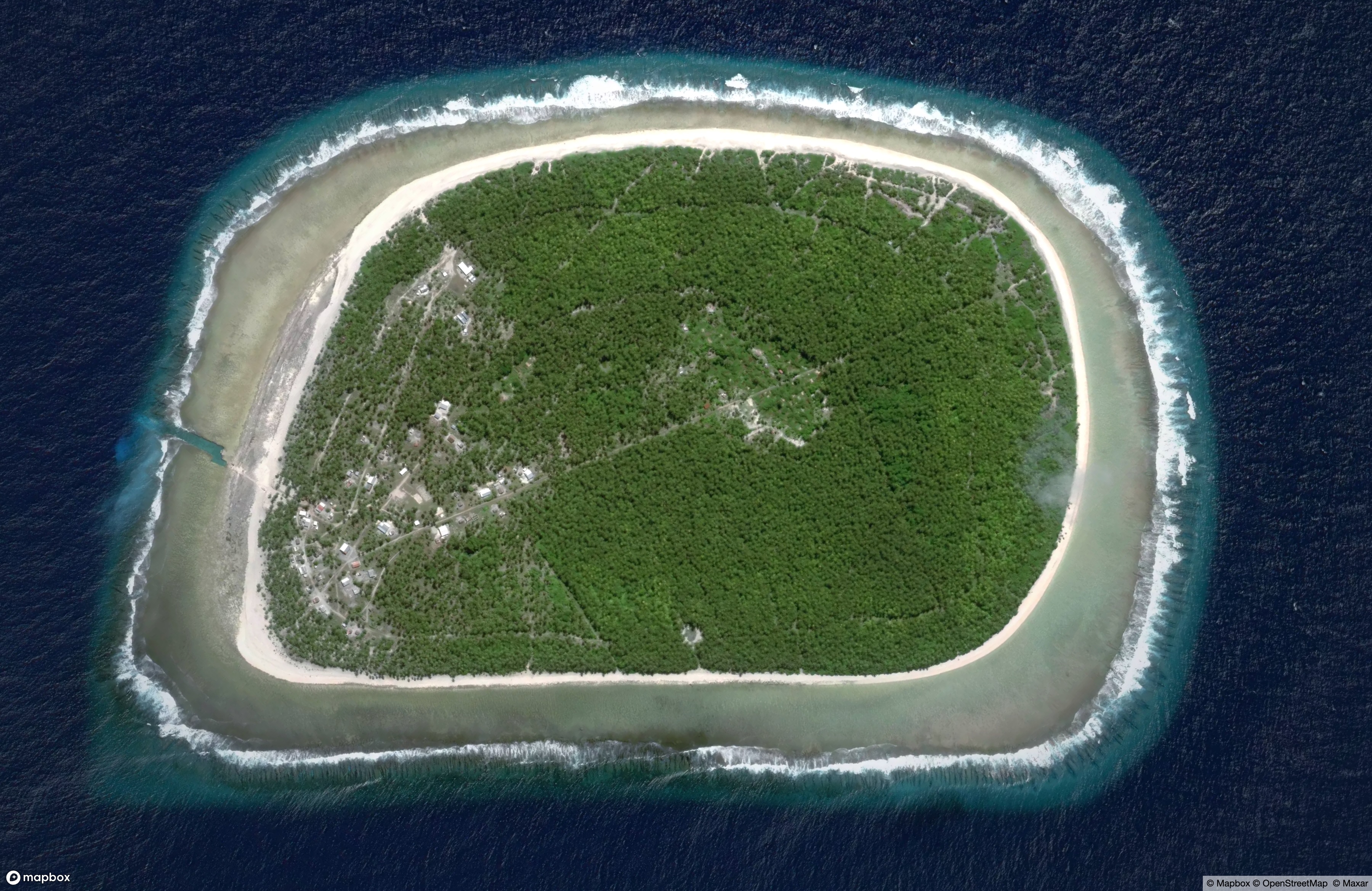
The Cook Islands are impossibly-remote, scattered in the South Pacific 500 miles from Tahiti and 1,000 miles from New Zealand, of which it is a “Freely Associated State”. If you were to visit, perhaps for the legendary snorkeling, you might fly to the main island of Rarotonga, home to about 3/4 of the nation’s 15,000 people. If your adventurousness got the better of you, it would be possible to hop a once-every-six-weeks flight to the Northern limits of the region, to Pukapuka Island (population ~500), beyond what American writer Robert Dean Frisbie called “the faintest echo from the noisy clamour of the civilised world”. But you could actually go further afield, 40 miles south by boat (no airstrip) to the half-square-mile island of Nassau (population ~80). In the center of the island, protected by thick groves of coconut palms, is a clearing of communal taro ponds, helping keep the locals fed.
Now, the island is named “Nassau” after an American whaler that anchored here in 1835. But this has led to an interesting sort of confusion. In Google Maps, user photos are helpfully associated with any searched place, giving a feel for what it looks like on the ground. If you look at the photos attached to this Nassau, you might see rows of cruise ships, shopping districts, NBA games on TV above open-air bars. These, of course, are all photos taken in Nassau, the capital of the Bahamas, and incorrectly geocoded by contributors. The life on the ground of the remotest Nassau is still beyond that faintest echo.
Cover image: Operation Buster-Jangle-Dog, Nevada Test Site, 1951
_002.jpg)