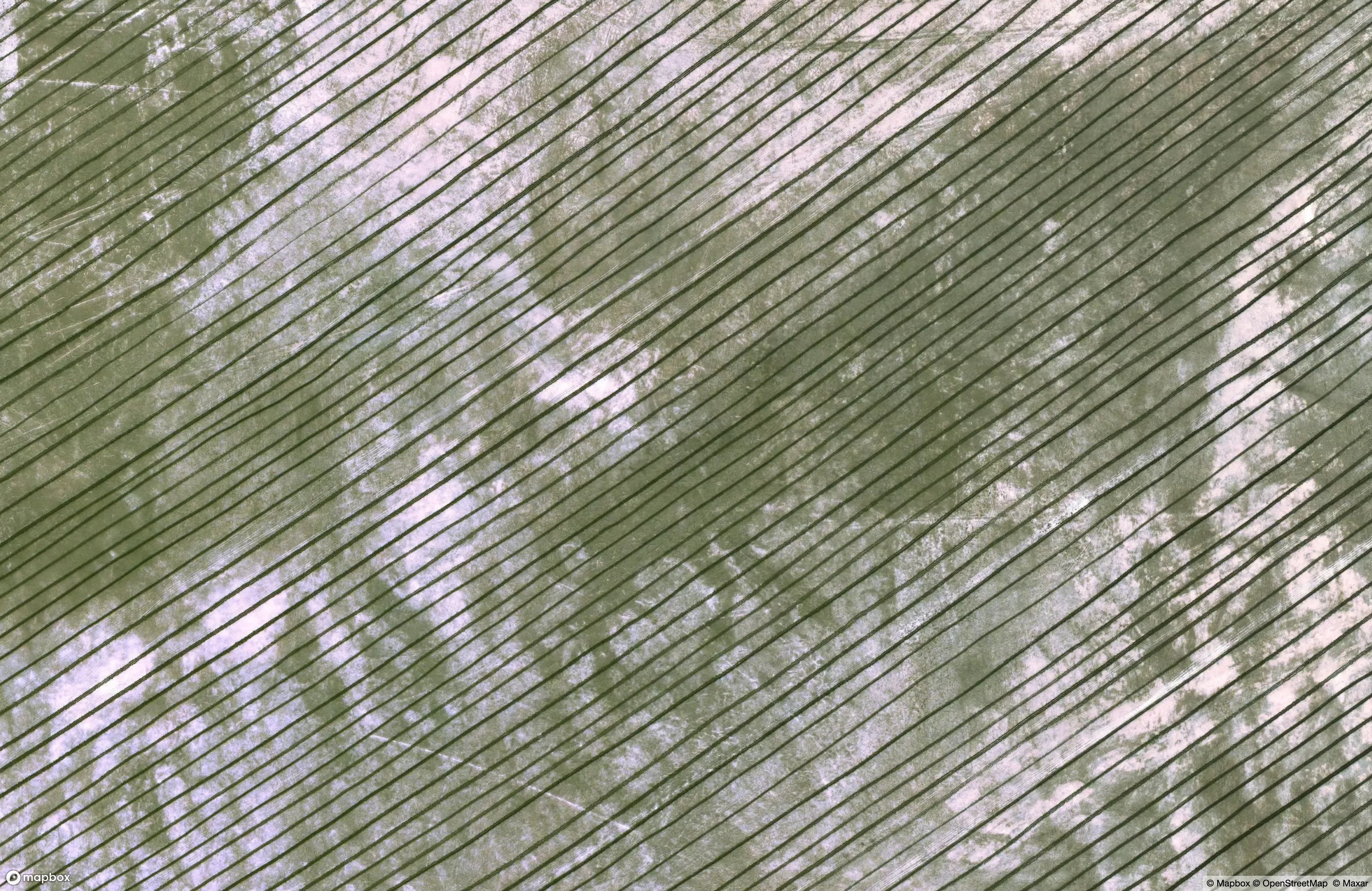
Deep, regular furrows have been carved into salt-capped clay in Northwestern Uzbekistan, along the border with Kazakhstan. Within my own lifetime, this spot was once deep underwater.
The Aral Sea is in fast retreat. This isn’t news, exactly; it’s been underway for half a century, and the locals are well aware. Beginning in the 1960s, the Soviet government diverted two feeding rivers away from the Aral and into vast cotton-production regions, planning for an economic boom; the result was catastrophic. From being “The Sea of Islands”, it first split into disparate water bodies as the water drained elsewhere, and then those bodies began to disappear. In 2005 Kazakhstan built a dam across the new drainage, stopping the bleeding from the branch now called the “North Aral Sea”.
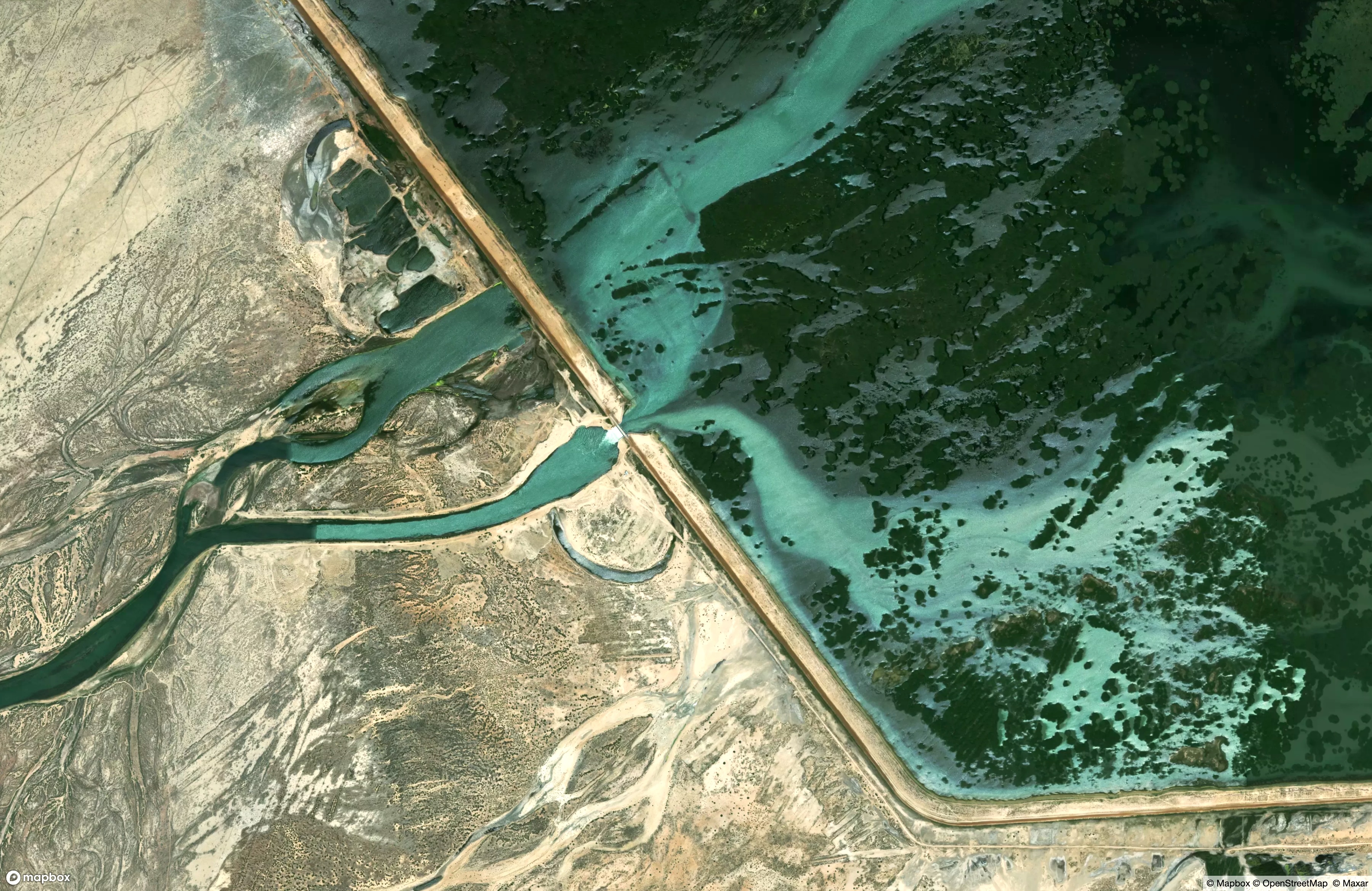 The Kokaral Dam, Kazakhstan
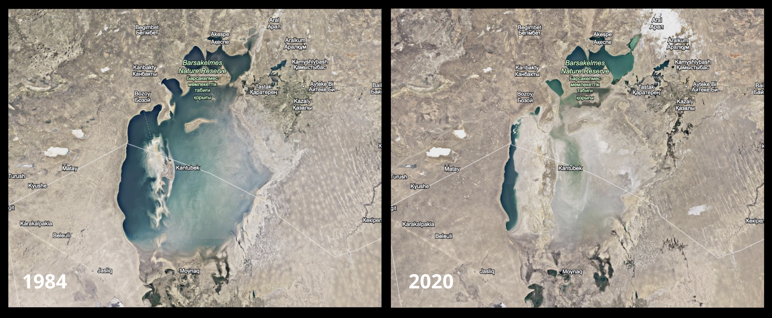
But by 2020, the broad sea had been reduced to 10% of its former surface area.
 Imagery captured by USGS Landsat instruments over nearly 40 years, via Google Earth Engine
The increased salinity of the remaining water drove fish species to extinction, forcing the abandonment of fishing communities that were in any case no longer located on any shoreline. The newly-exposed seabed dried, cracked, and flowed into the air on prevailing winds, sometimes coalescing into sandstorms. These carried a new threat to human and environmental health, in the form of the many industrial and agricultural chemicals that had been deposited in the seafloor sediments over decades, now made mobile on the breeze. And unknown dangers remain in the form of the abandoned, Soviet-era Kantubek bioweapons lab, once located on an isolated island in the middle of the Aral, now perched on a knoll above a new desert, and exposed to the same winds.
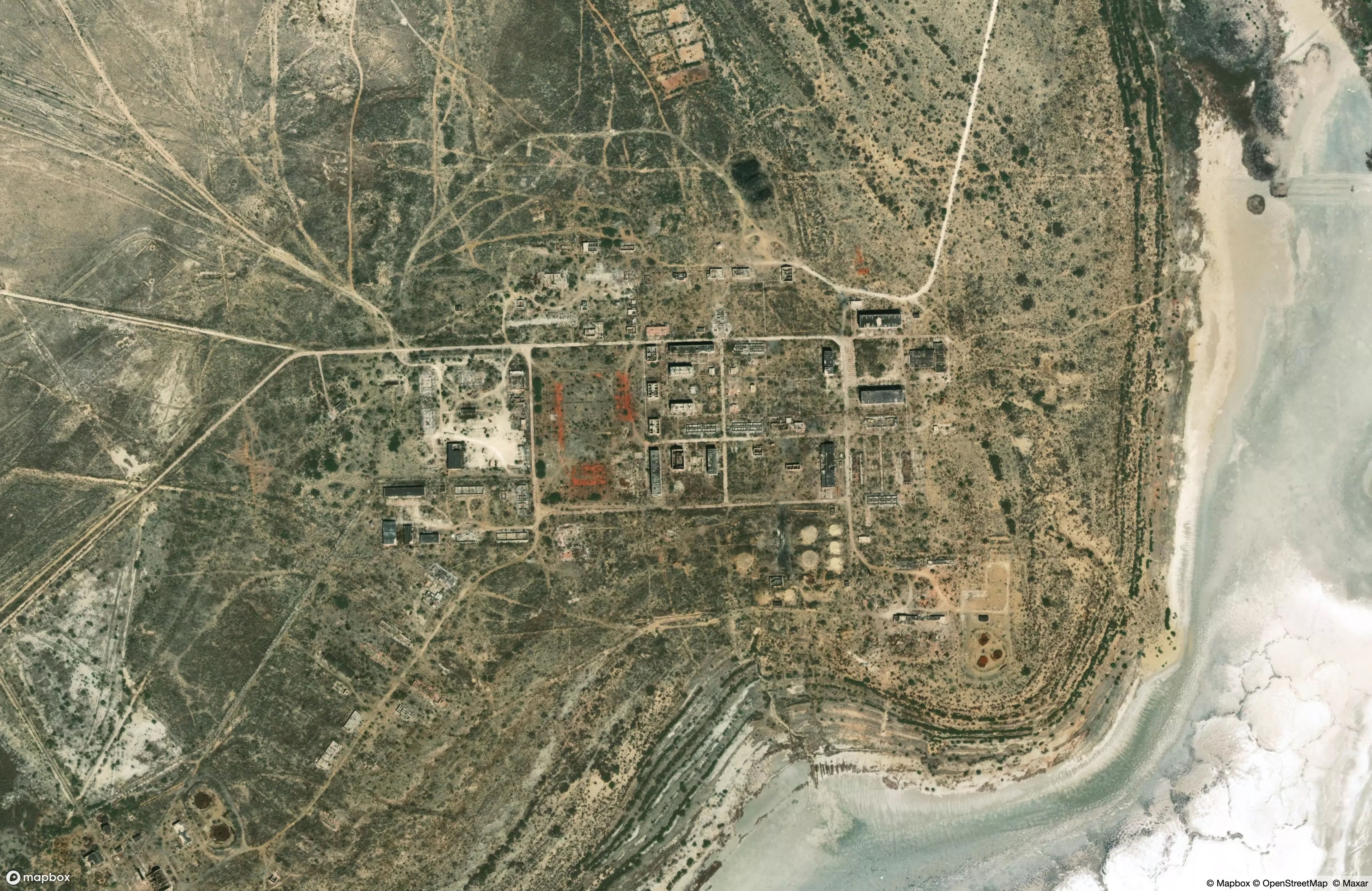 The Kantubek facility, present day
This brings us back to those furrows. Without water to hold down the dust, and without vegetation to slow the winds, various projects have begun to tame the new landscape. This includes the system of windbreak trenches that is clearly visible in satellite imagery along the Southern and Eastern shores of what now remains of the Western Aral Sea. In some cases, these are the groundwork of massive planting campaigns, using native Black Saxaul shrubs to bind the sand from the relative protection of the dug rows. Thousands of miles of trench have already been plowed, funded partly by the now-dismembered USAID, as well as by the World Bank. On the vast open desert that once was a seabed, some of the workers have taken the time to carve the names of Uzbek cities into the ground:
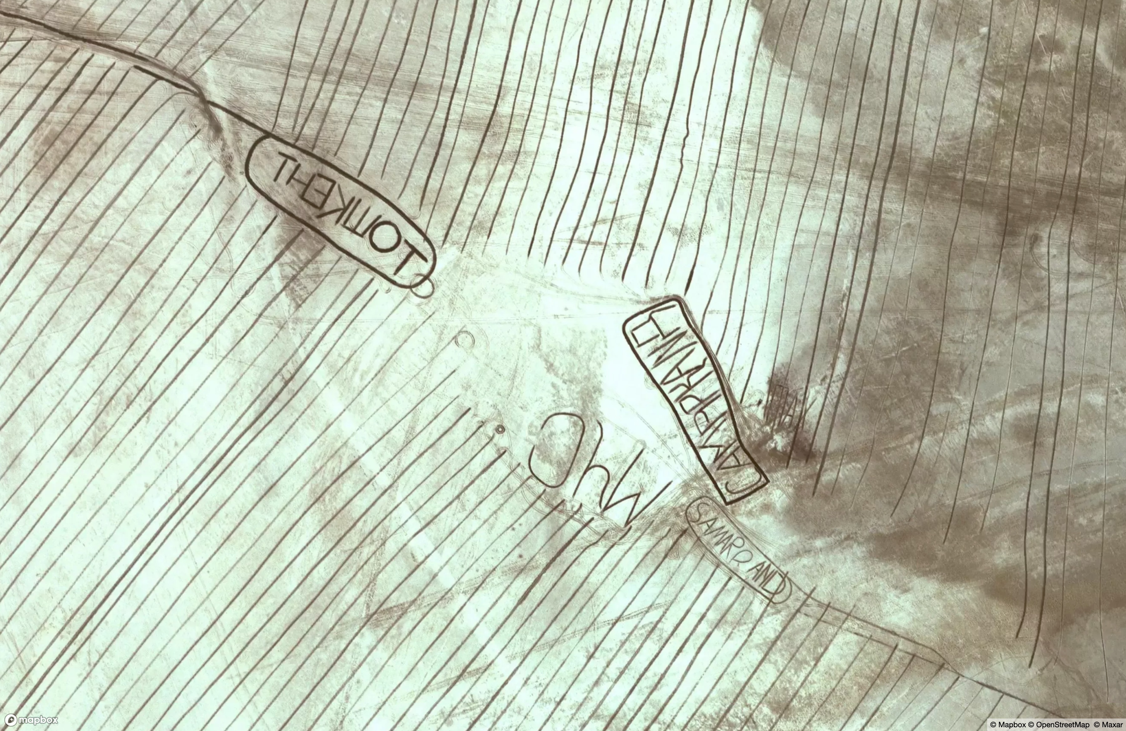
At some point, in the midst of this moonscape work - hopefully from the shelter of an air-conditioned tractor cabin - an Uzbek operator detoured from the furrows and began carving a new mark. He [probably he] drove arcs together, pierced with straight lines, clearly digging over the same tracks to deepen and widen them. He made a precise figure, with no small amount of skill:
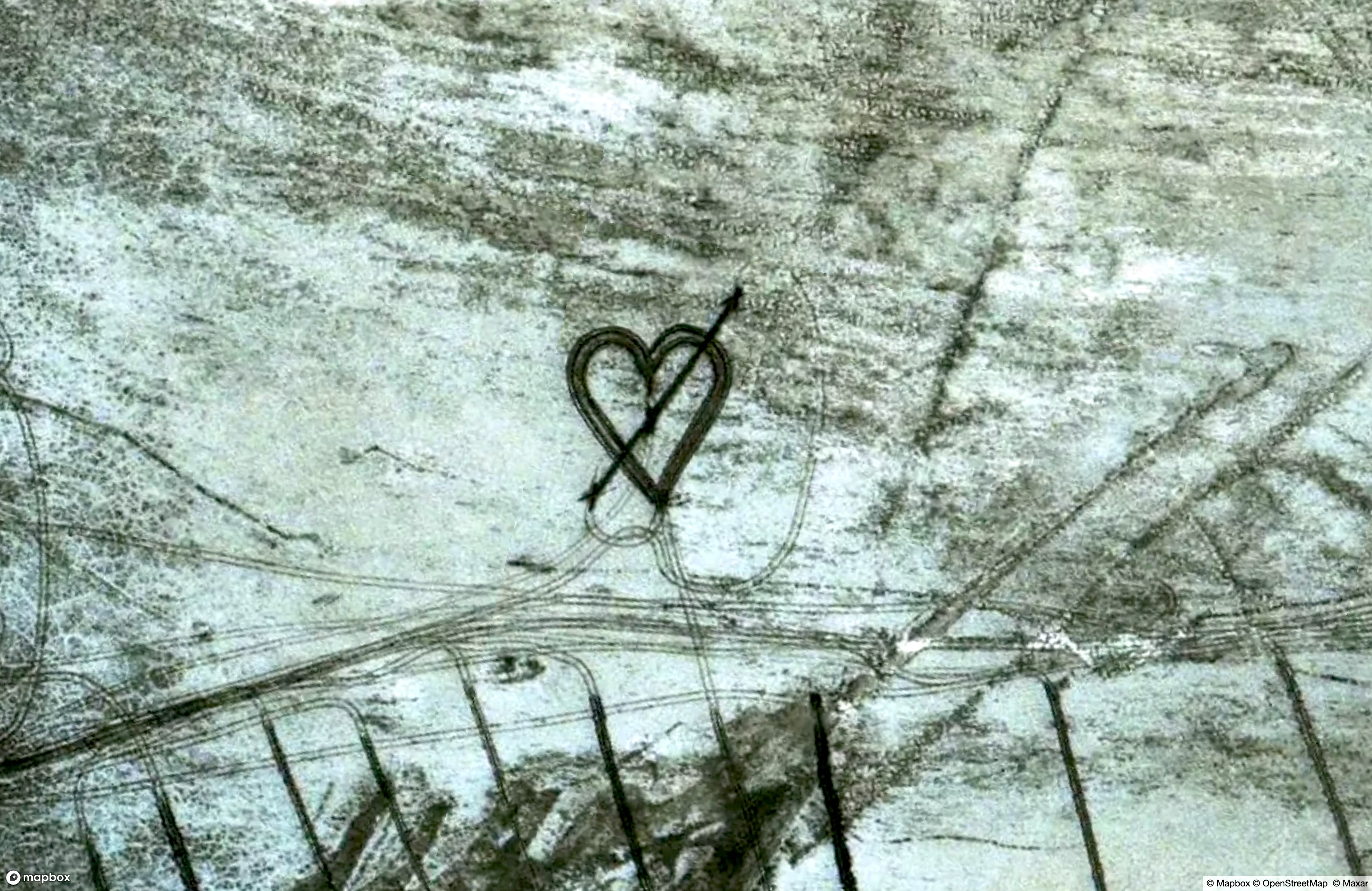
It seems to me that no one could do this without a baseline of humor and hope. I take it as a gift of those things, visible however briefly from space.