A total solar eclipse is coming to Vermont! Burlington is right in the path of the totality! Every hotel room and rental in Chittenden, Franklin, and Grand Isle counties is booked! Transports are sold out! The scale of the tourism impact is being compared to multipliers of Super Bowls!
A quick look at this Great American Eclipse map of - for lack of a better term - “drivesheds” suggests that the entire populations of Boston and New York will be motoring North to join us for the event:
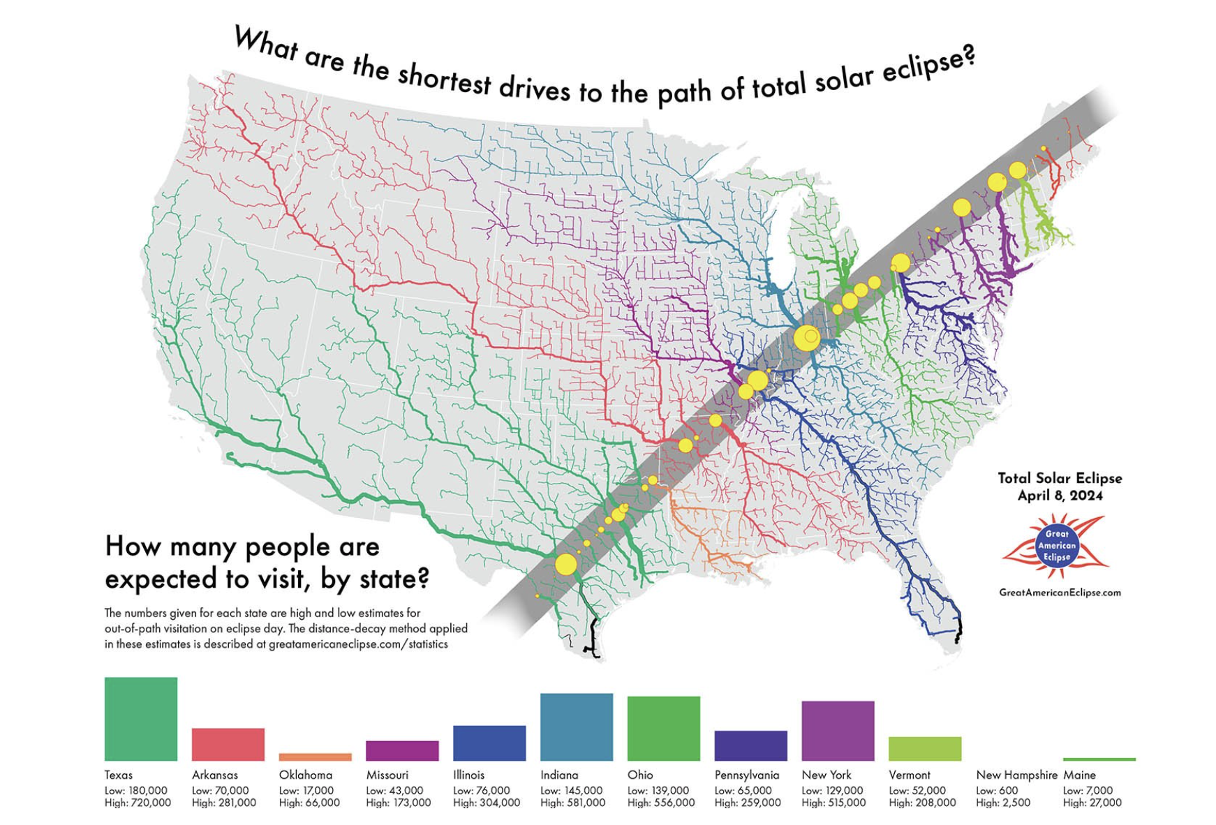 Map by M. Zeiler
We’re all very excited. Just look at this trajectory up close:
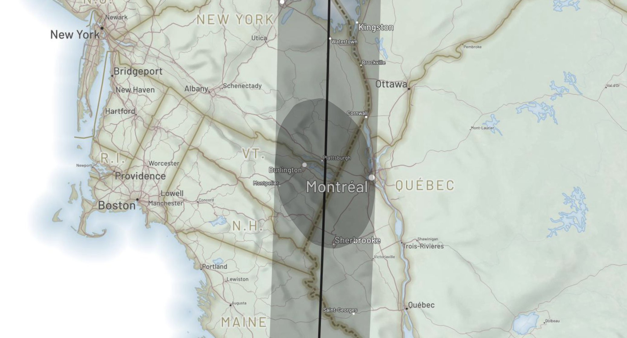 Map by A. Woodruff
The path of the eclipse leaps away from the St. Lawrence as though it simply must cast its scary visage on the Champlain Valley. In fact, this perspective rightly brings Canada into the mix, in particular the millions-strong city of Montreal, located just close enough to the edge of the path that some of its citizens might be pondering a drive South. For more of what I consider the most amazing maps you’re going to see about this event, check out the inimitable cartographer Andy Woodruff’s piece from a few months back.
I’m as happy as the next green-blooded Vermonter about being the center of attention during a momentous event (I’ve bulk-purchased viewing glasses for the friends and family who’ll be rolling in for the festivities). But as a longtime Burlingtonian, I’m . . . uneasy. You see, beneath our veneer of majestic mountain vistas and pristine natural environment lurks a dark secret:
Seattle has more sunny days per year than Burlington.
We turn now to a different map; perhaps a less-joyful one. A map by the data-ninja Chris Ingraham from his days at the Washington Post. A map that makes it clear we’re dealing with a potentially bleak roll of the dice for being able to actually see the totality when it flies overhead. A map of the likelihood of overcast skies.
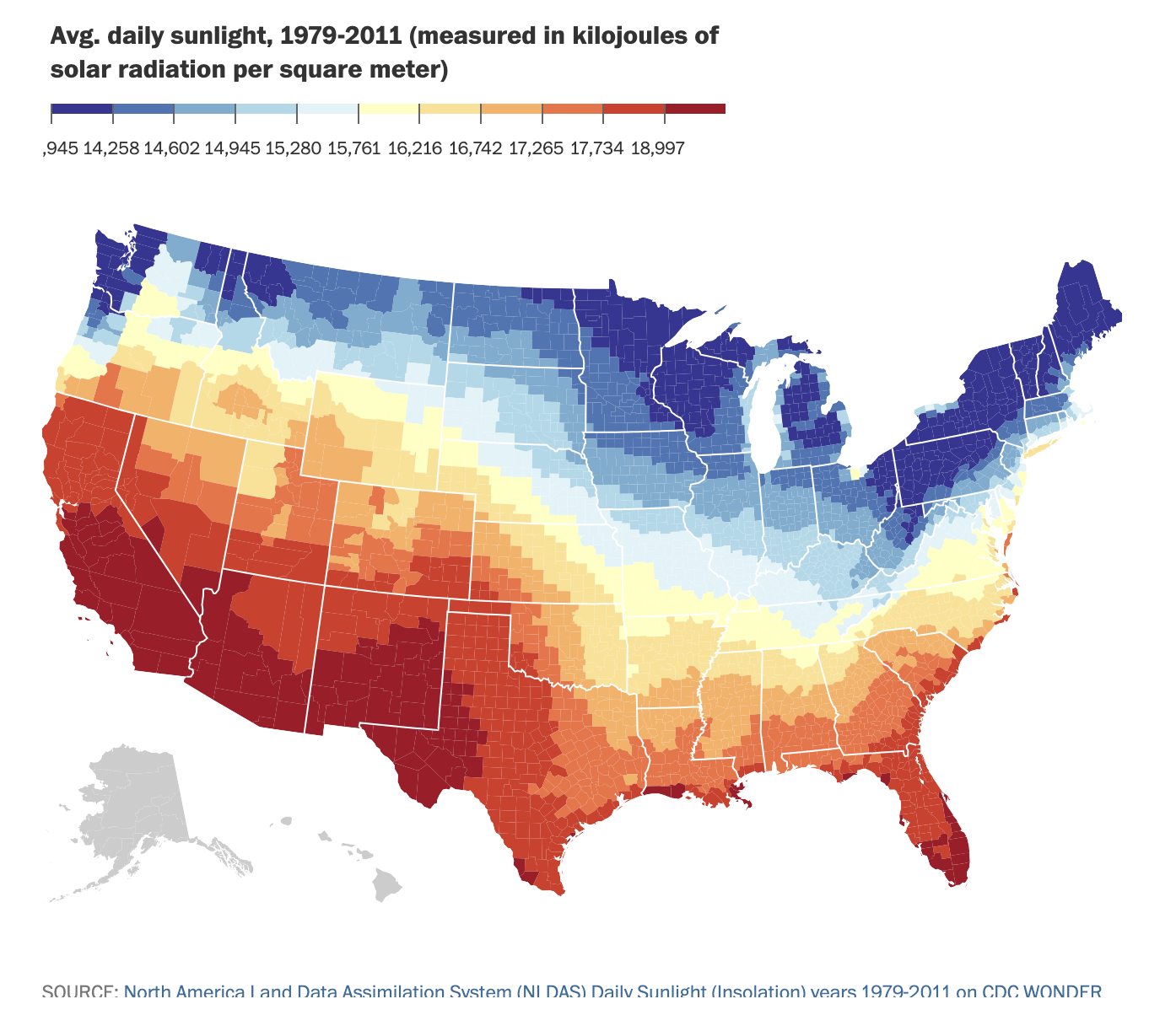 Map by C. Ingraham
(This piece is 8 years old, reflecting data that is over a decade old, but if anything the cloudiness situation may be trending worse.)
Other sky-watchers have taken the clouds into consideration when planning for the eclipse. This thorough report from Eclipsophile shows that we’re at 70% likelihood of cloud cover in April! But it could be worse - heaven help the folks in Montpelier, or those likely ascending into the Jay Cloud. Hell, we could be in Jackson New Hampshire, pushing 90% likelihood of overcast.
The gist seems to be that local relief (i.e. the presence of mountains) increases the likelihood for cloud cover. Plattsburgh might be your best bet for the Northeast, and lord knows they could use the tourism. If you’re up for a beast of a road trip, Prince Edward Island could be the only clearer look this side of the Mississippi.
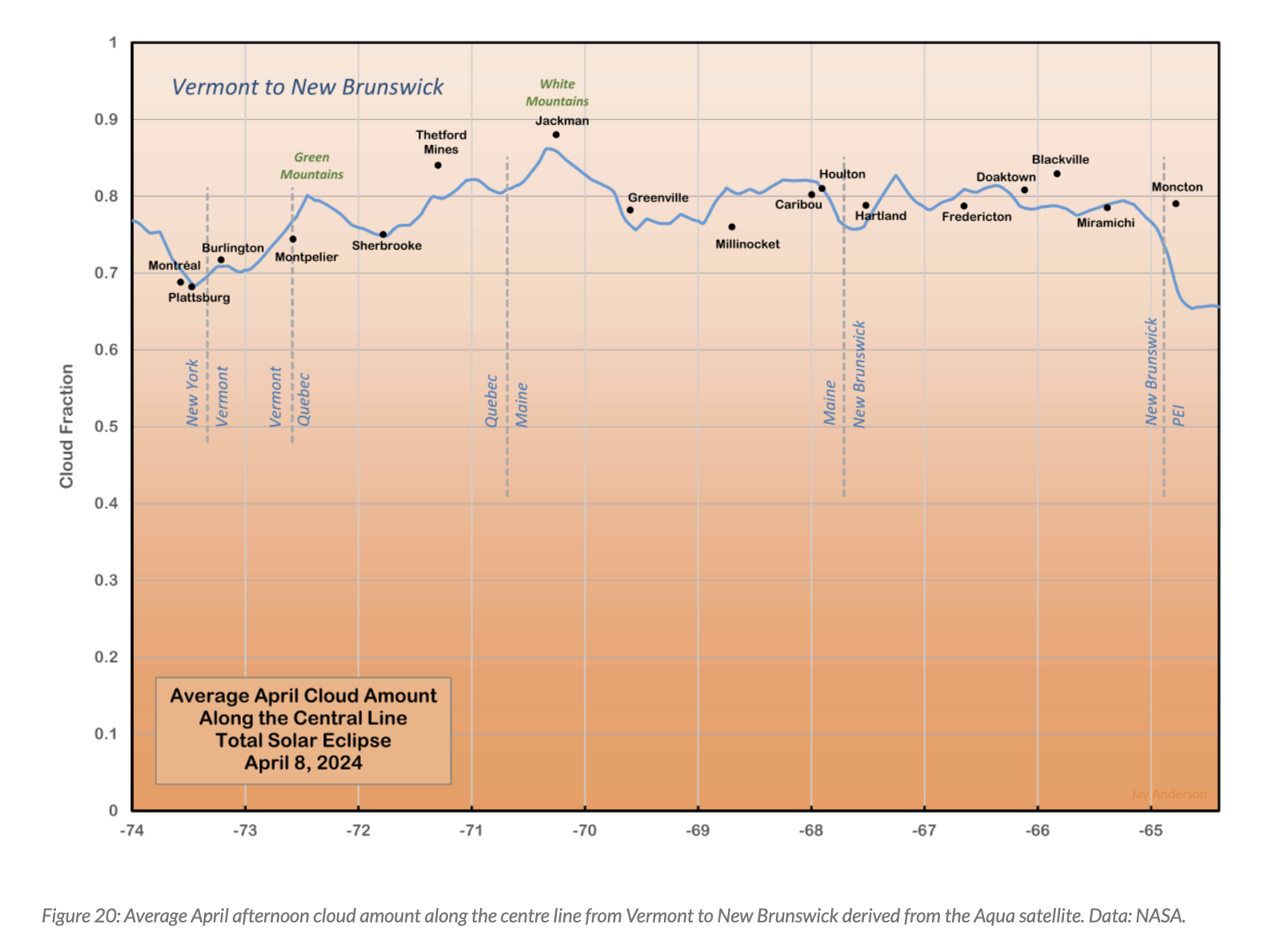 Transect map by J. Anderson
I’m not actually surprised that I haven’t seen this potential for cloudy party-ruination mentioned in the increasingly breathless local press about the event. We’re Vermonters; we may seem cold (Thanks, Noah), but deep down we’re an optimistic lot. I’ll be crossing my fingers.
(Here’s a GeoJSON file of the eclipse centerline, if you’re looking to do some mapping of your own.)