In the course of a lifetime in the almost-accidental study of Earth observation, I’ve found that - over centuries of innovation - humans have tried a million strategies to build the Tower of Babel; not to compete with god, exactly, but to see ourselves more clearly. Inevitably, I’ve acquired a collection of craaaaaazy stories from this field, and the wildest often turn out to be true. These are some of my favorite examples from the offbeat evolution of remote sensing, in roughly-chronological order.
Originally given as a talk at the inaugural SatCamp in Boulder, CO, this has been largely stripped of my clowning to let the amazing images speak for themselves.
1838: Tall buildings
Fresh from the invention of one of the first legitimate photographic reproduction technologies, Louis Daguerre set up his camera on a rooftop in Paris’s 3rd District on a busy morning in 1838. Of note is the length of exposure at the time: 4-5 minutes of light intake meant that only the man having his shoes shined in the foreground was stationary long enough to appear in the final product.
#/media/File:Boulevard_du_Temple_by_Daguerre.jpg)
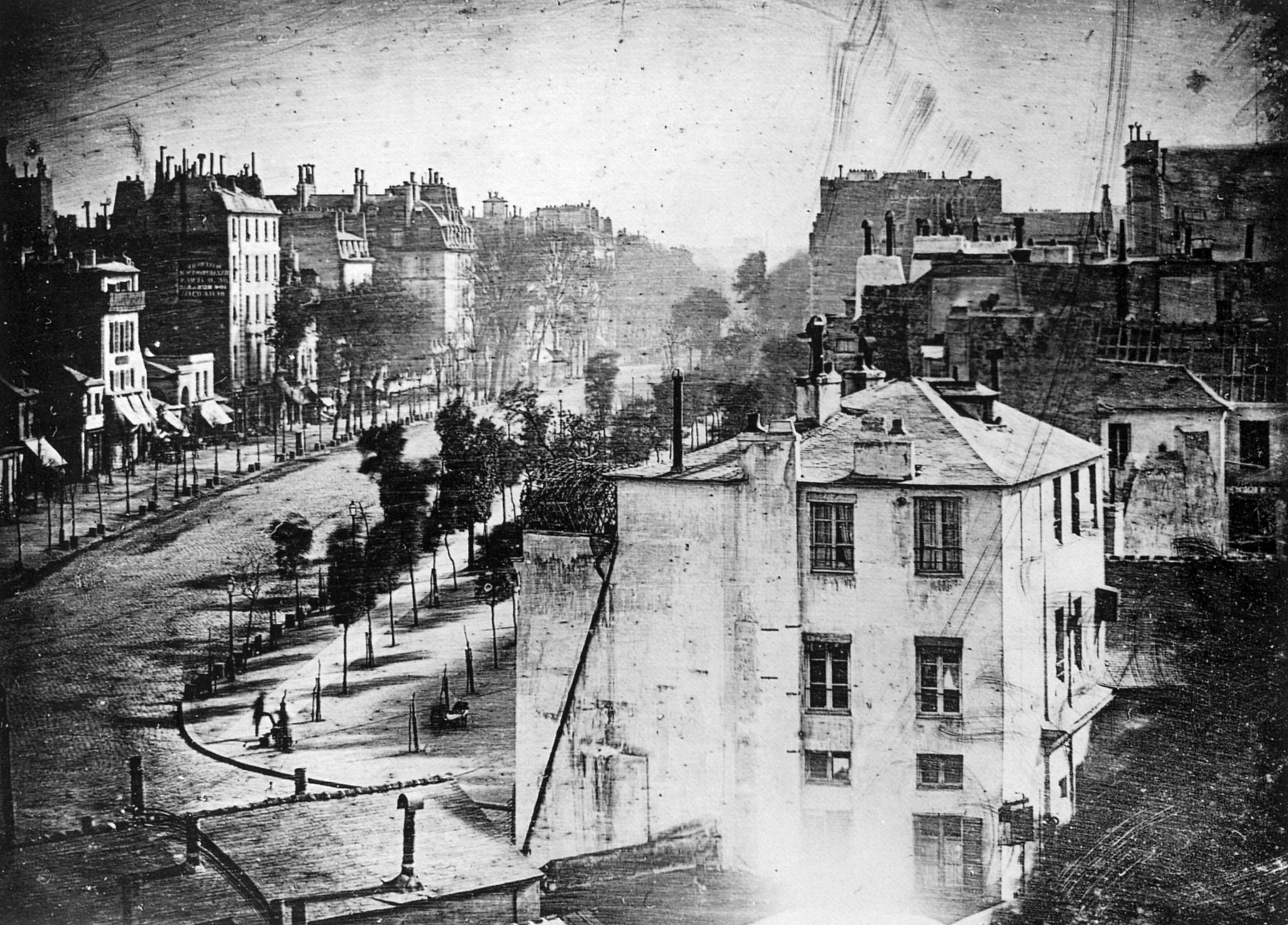
“Boulevard du Temple, Paris, 3rd arrondissement”
1858: Balloons
Gaspard-Félix Tournachon - AKA Nadar - was at once a photographer and a balloonist, and he saw the potential. Though none of his aerial photographs survive, he developed new postprocessing technology and is recorded as the first aerial photographer.
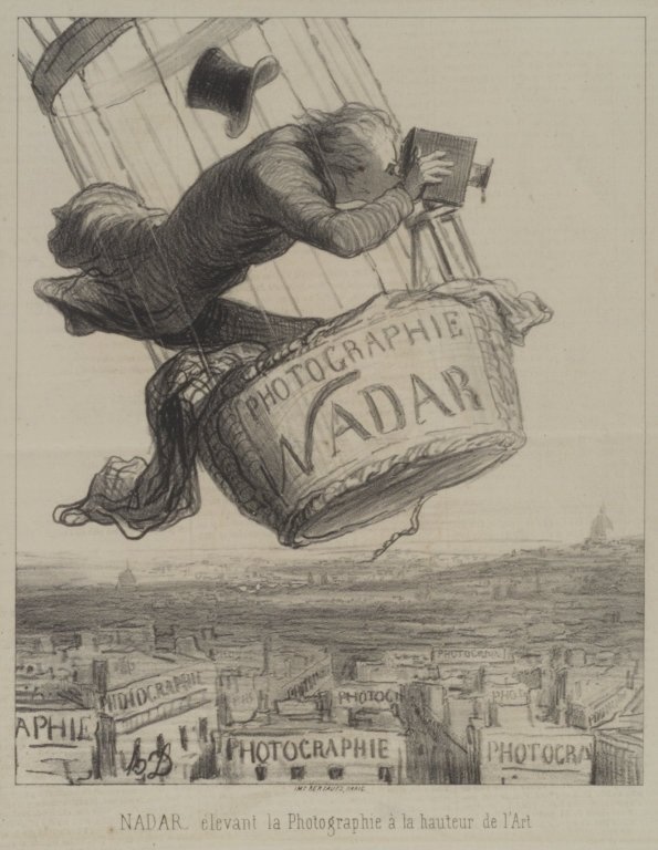
“Nadar élevant la Photographie à la hauteur de l’Art” - Honoré Daumier
1860: More balloons
Fortunately, James Wallace Black’s balloon photo of Boston from two years later does survive, and it’s now held by the Met in NYC.
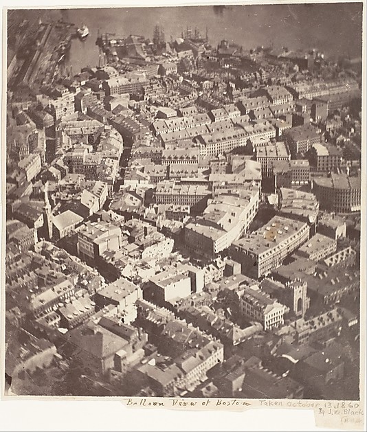
“Boston, as the Eagle and the Wild Goose See It”
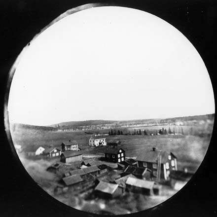
1889: Kites
Arthur Batut took it a step further, even publishing a manual on how to take photos from the decidedly-less-stable platform of a kite.
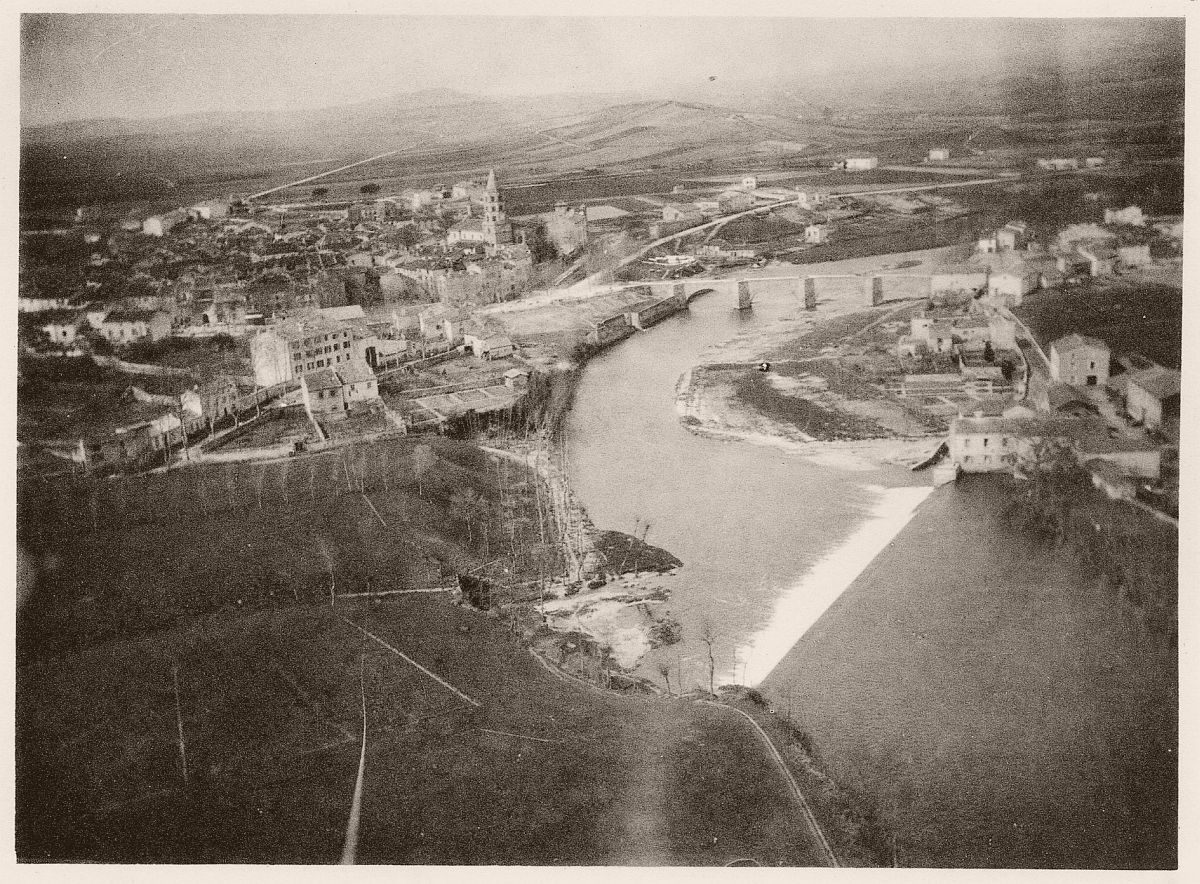
“Labruguière, 1889”
1897: Backyard rockets
Having developed a bunch of methods for making bigger explosions, Alfred Nobel turned his thoughts to propellants and their applications. One of those, “An Improved Mode of Obtaining Photographic Maps and Earth or Ground Measurements”, was implemented just after his death, resulting in a photo taken from a rocket for the first time. The alarming proximity of the rocket to residential buildings would ideally be rectified later.
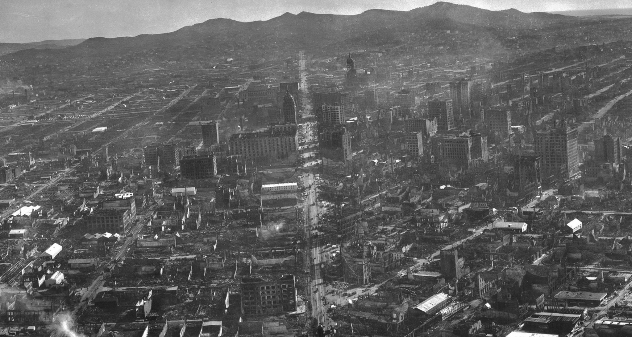
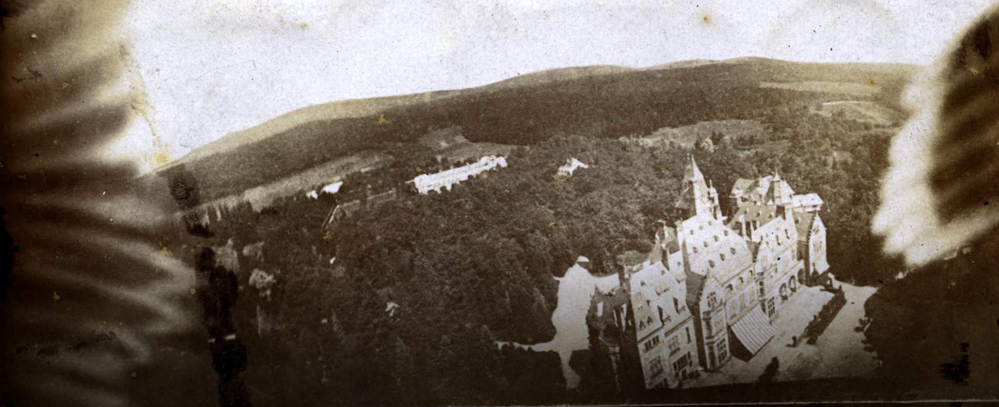
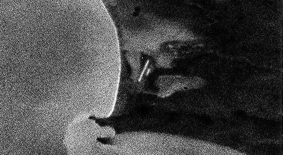
1906: Seventeen kites at once
San Francisco was captured in incredible detail in 1906 by George Lawrence, using a remotely-triggered panoramic camera attached to a kite array called the “Lawrence Captive Airship”.
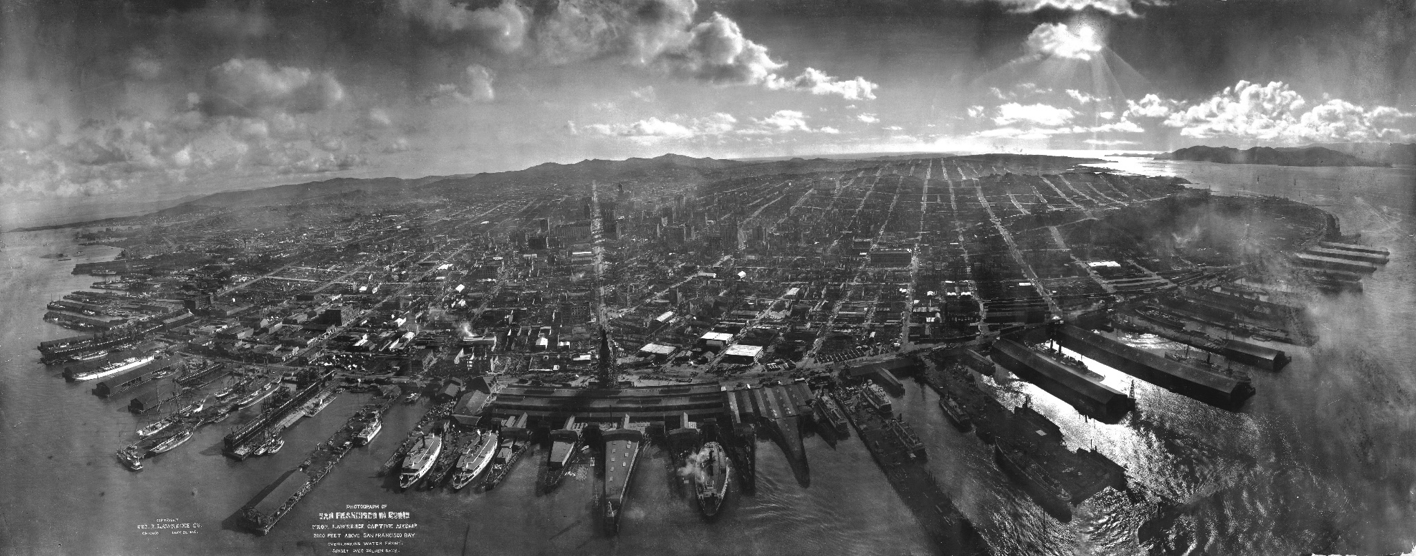
The purpose of this photo might be clear to anyone familiar with that year in Bay Area history: it was an incredible preview of the potential for aerial damage assessment, applied just after the great earthquake:
1909: Pigeons
Julius Neubronner figured out how to get homing pigeons to deliver medicine, then saw the potential and designed a harness to attach a camera to the trusty little avians. This was, of course, immediately put to military use.
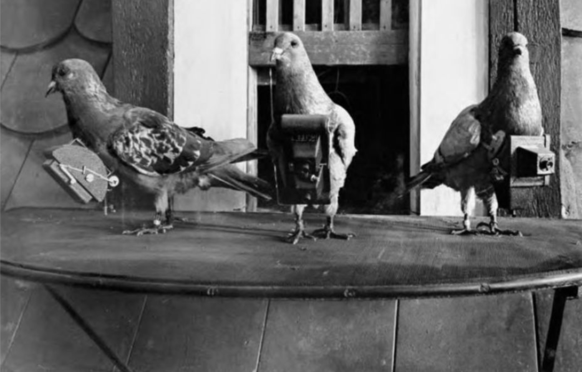
. . . and also resulted in the first instances of “thumb over the camera” outtake shots:
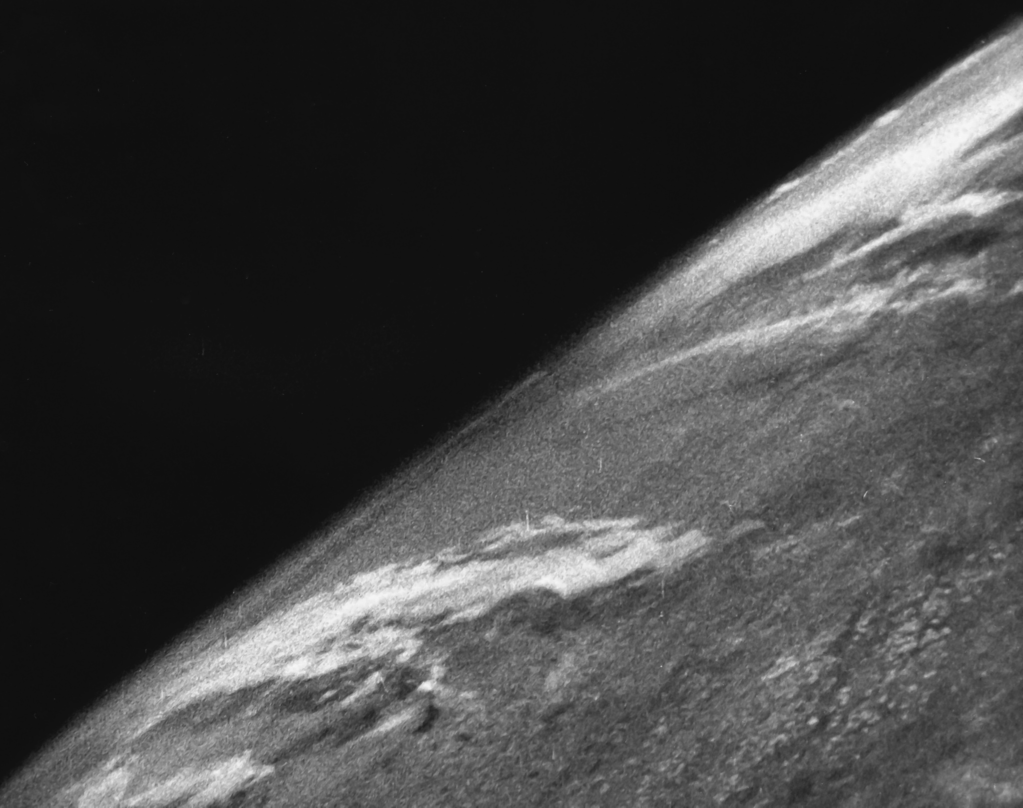
1946: Captured nazi rockets
Having “liberated” a collection of German rocket scientists and unused ordnance at the end of WWII, the US Army began testing all manner of payloads.
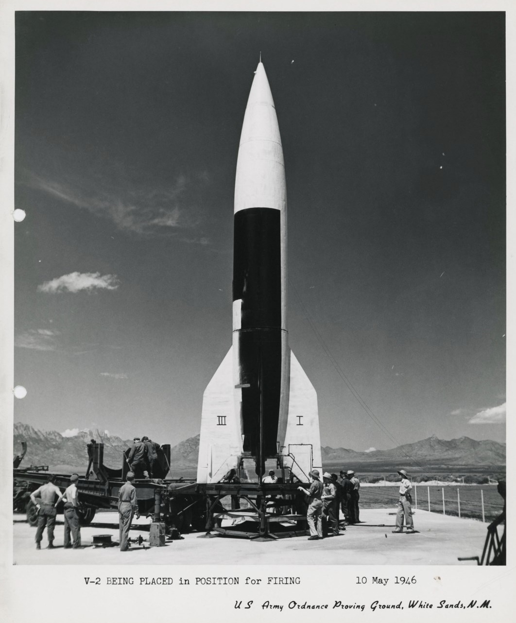
“V2 being placed in position for firing”
This included a camera on a nearly-orbital flight, resulting in the first image of the Earth captured from space.
1960: Cigar-shaped satellites
Prior to the development of digital imaging that could be transferred by radio downlink to the surface of the Earth, pictures taken from space were tough to retrieve. The CORONA satellite system was designed to make it possible, using some Wil-E-Coyote level antics with parachutes on film canisters and hooks on planes, and some very precise orbital calculations.
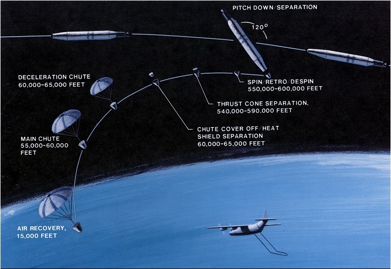
The resulting images may have been useful in the gathering of intelligence over hostile airspace, but the resolution left something to be desired.
CORONA image of either a forward Soviet air base or a lens smudge
2024 update: in our flourishing era of deep learning, archival imagery from the Corona series and its successor Hexagon have been put to some very cool civilian applications.
1973: A pickup truck
The orbital vehicle known as Landsat-1 looked a lot like a Dalek . . .
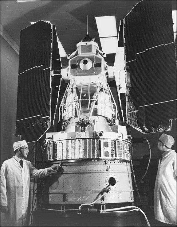
. . . but that’s neither here nor there, because we’re talking about the truck that was used to bring the Multi-Spectral Scanner (MSS) prototype to Yosemite by Virginia Norwood and her pioneering team for testing one day frightfully close to the Landsat launch date.
Norwood had researchers load a breadboard version of the scanner onto the back of a truck. It amounted to “just a bunch of boxes,” she says. “We could use all the weight we wanted.” They drove around California, scanning Half Dome, Yosemite Valley, and San Francisco’s skyline. Having labored so long over the specs, Norwood wasn’t surprised by the high quality of the test images.
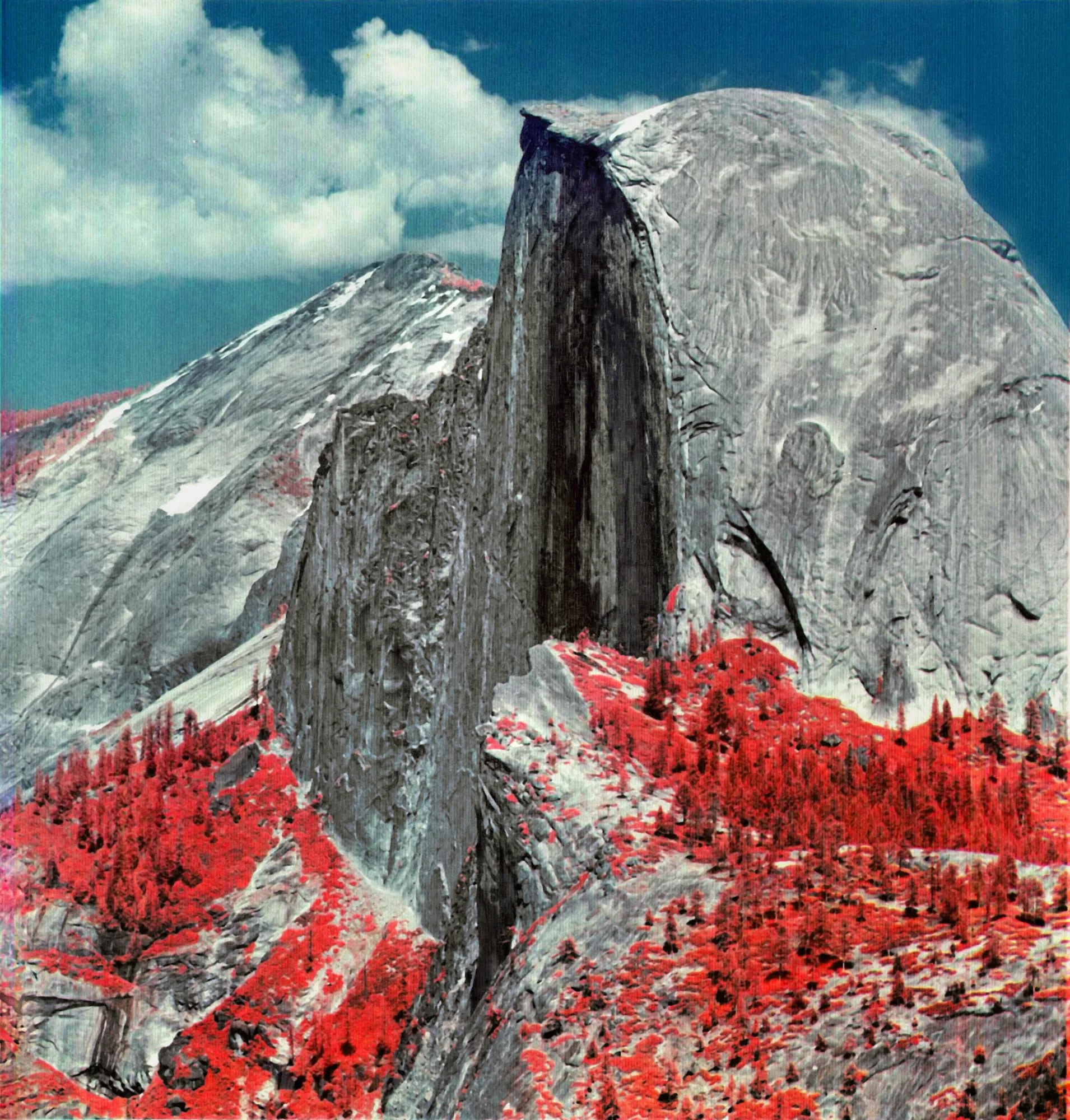
It feels like a special kind of bonus prize that - from the project that would go on to give us a fifty-year, uninterrupted look at all corners of our changing planet - we also get a beautiful false-color composite of Half Dome:
Cover image is author photo of “Vue générale de Paris, prise de l’Observatoire, en ballon”, by Victor Navlet, 1855, Musée d’Orsay