Lunuwila, Sri Lanka
In a country the size of Sri Lanka, it didn’t take much zooming in to notice the large, conspicuous, rectangular shape near the Northwest coast. On investigation I discovered that it’s functionally a wall of forest surrounding an ordered grid of palm plantation protected (hidden?) within. Coconut palms, specifically, for this is the home of the Coconut Research Institute of Sri Lanka, founded almost 100 years ago for the study and disseminaton of agronomic information on everyone’s favorite multipurpose fruit & fiber crop.
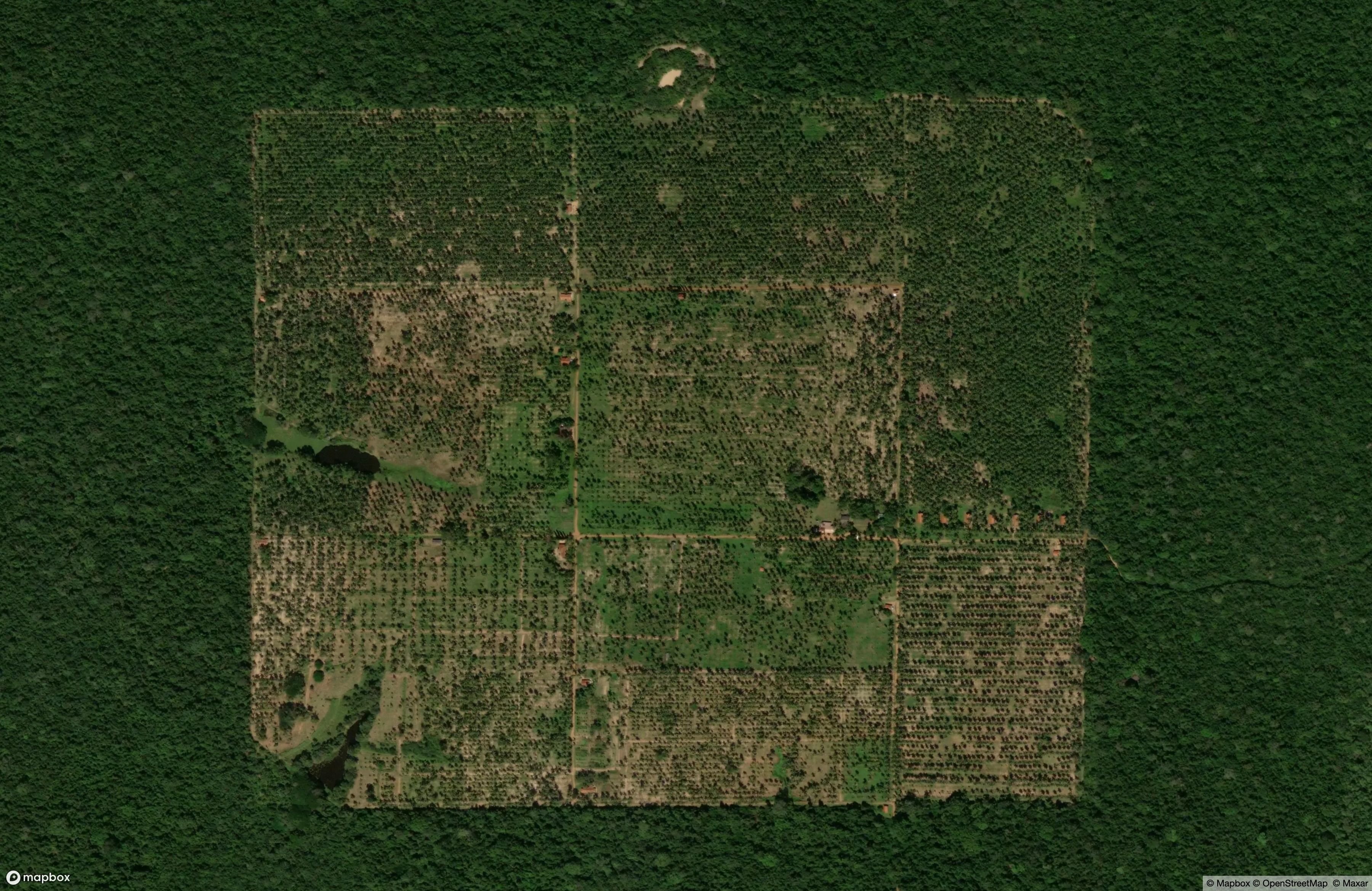
The CRISL’s academic footprint seems a bit hard to follow after 2023, but one of their studies caught my eye: “Nutritional Properties of De-fatted Coconut (Cocos nucifera L.) Testa Flour Incorporated Sri Lankan Traditional Food: Roti”. Wading through the discussion of crude fiber and protein content, it turns out that - within this cool shape of an agronomic system - they’ve discovered that you can grind down the otherwise-useless coconut testa (the stringy bits) and use it as an ingedient in roti. Having typed that, I am now hungry.
Kimberly Coast, Australia
While investigating a beautiful image of the remote Rothsay Water in Western Australia posted by Robbi Bishop-Taylor, I stumbled further West along the coast, and onto a shard of land that looked like it had been hollowed out with a melon baller. This is Koolan Island, part of the homeland of the Worrorra Aboriginal people, and site of large-scale surface mining since the 1950s. The pit extends deep below sea level and is kept dry - with mixed success - by massive seawalls. The iron ore extracted there is shipped on freighters like the one visible here, passing through rich inland waters on the way to [mostly] China.
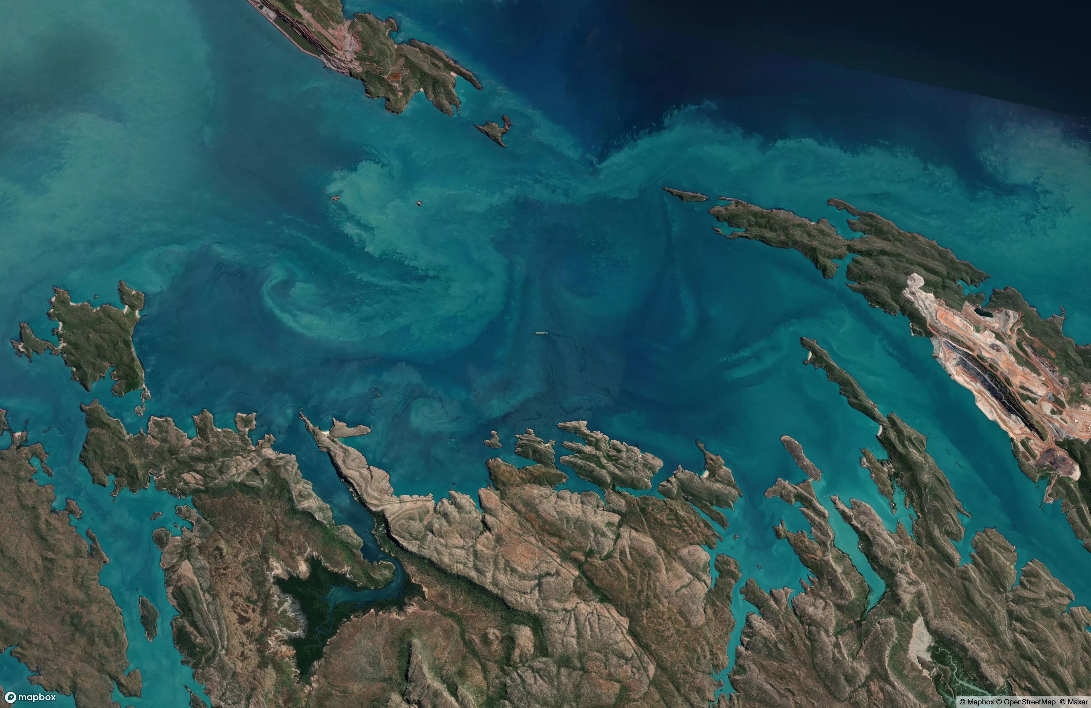
The island once boasted the longest single golf hole in the world, clocking nearly 1,000 yards and doubling as the airstrip (I assume the golfers needed to be tuned into air traffic control). The record has since been surpassed on courses in Japan and Korea, and the Koolan course has been closed for safety.
Uruk
Predating the founding of Babylon by a solid 3,000 years, Uruk is the oldest known city on Earth. Possibly after a shift in the course of the Euphrates river, it was largely abandoned to the desert by the time Alaric and the Visigoths rolled into Rome, by the time Li Yuan initiated the Tang dynasty, and - maybe more pertinently - by the time Abu Bakr and the followers of Muhammad established the Rashidun caliphate, including the part of modern Iraq where Uruk stood.
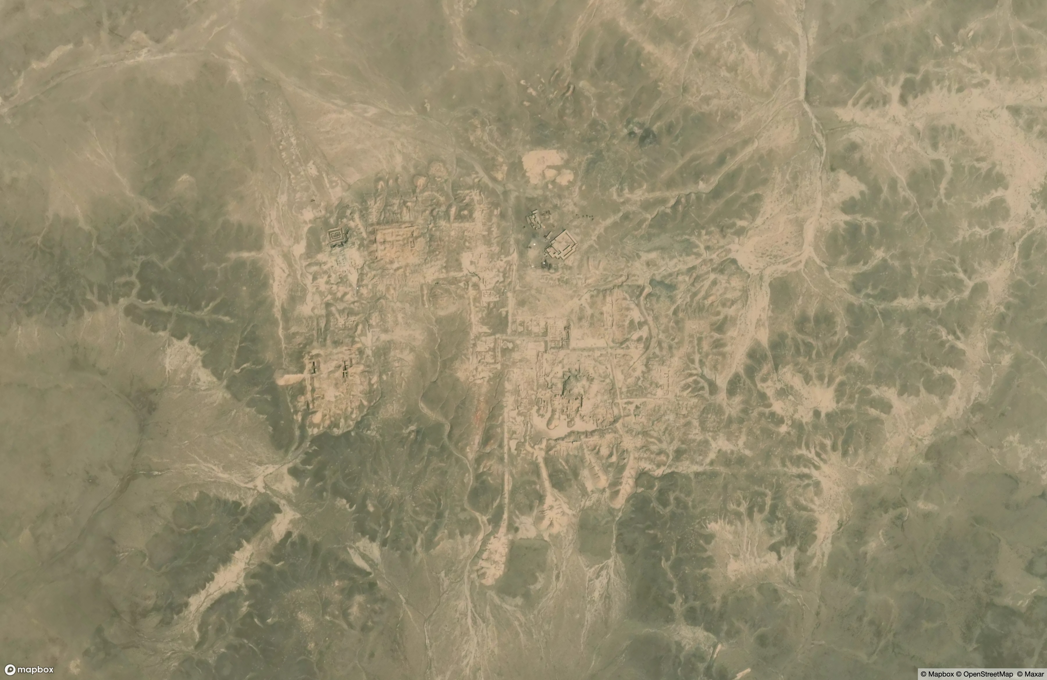
But these events might as well have been last week in the scope of human history. The invention of writing - in Uruk, as it happens - created the start of a series of parallel records that we can refer to today. We have more than six thousand years of agricultural accounts, prayers, and shitposts from all over the world, and we can check various threads against each other. This is one of the activities I find most satisfying about history - being able to know what the Maya were up to when the Achaemenids were nervously eyeing Macedonia.
So a satisfying note of historical convergence is this:
Had a citizen in the early days of Uruk been particularly hearty and particularly adventurous, they could have traveled North, crossing the Caucasus mountains, then the Urals, then the great expanse of Siberia. At the shores of the Chukchi sea, they could have constructed a sturdy-enough boat and cast toward the Arctic ocean. They could have sighted an island the size of Crete and made landfall. There they could have seen the last herd of wooly mammoths, shortly before the species’ extinction.