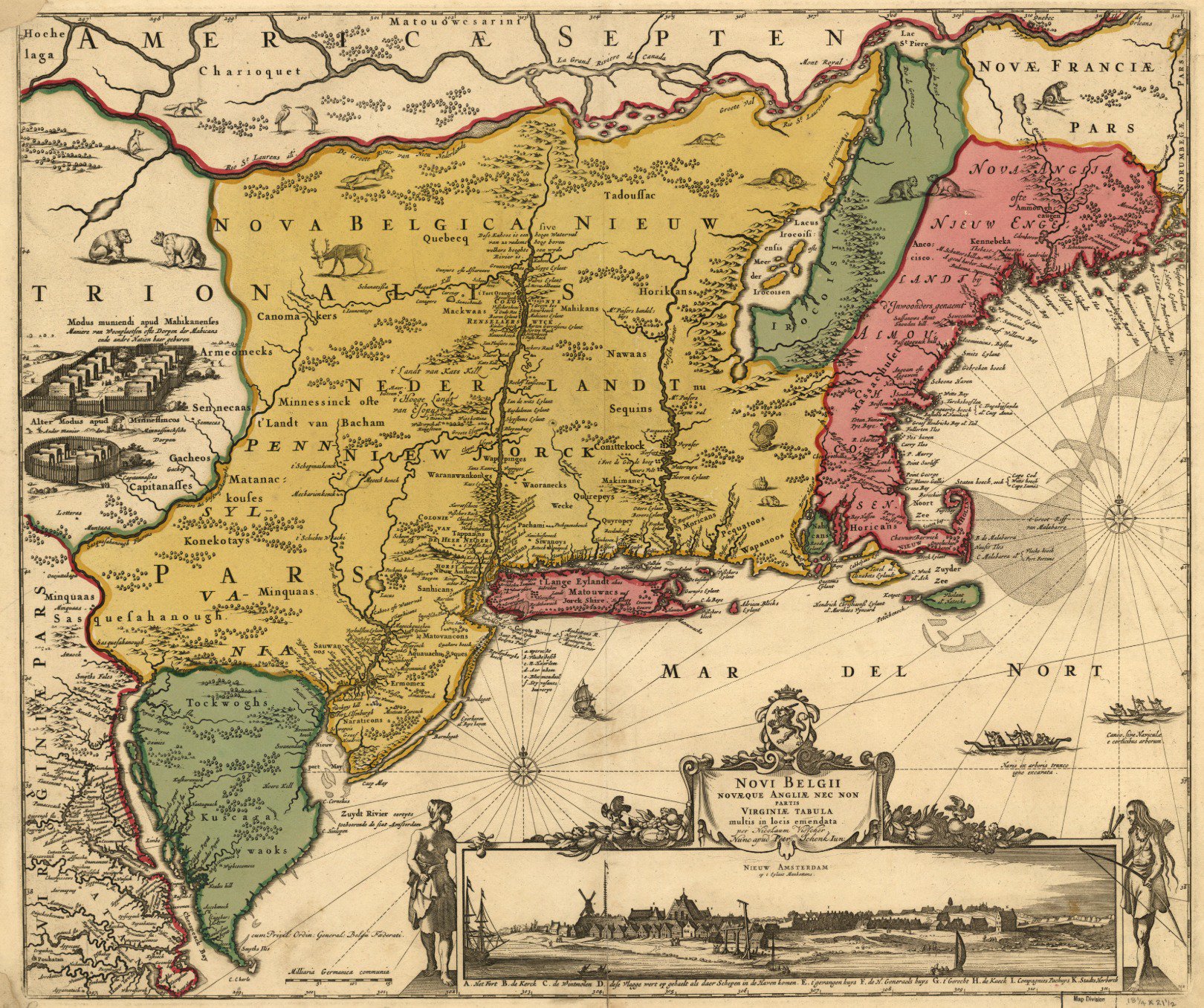
I found an old map of my corner of the world, in Dutch. Made by Nicolaes Visscher I in 1650, this version is held by the Library of Congress.
The broadest region on map is labeled “New Belgium” (geographically unrelated to the brewer of Fat Tire); it shows Dutch holdings before English and French consolidation.
The names are a glorious tangle of
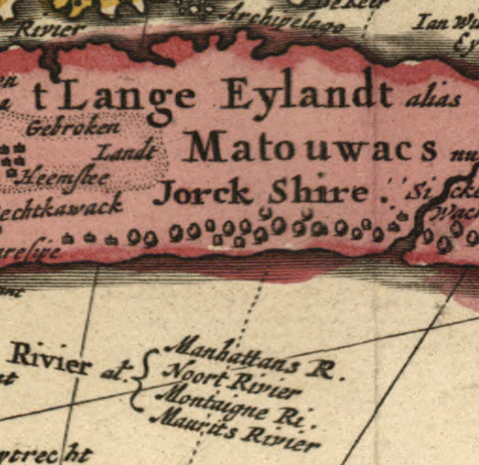
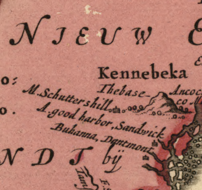
- 1600s Dutch translations of English, French, Wabanaki, and Haudenosaunee placenames
- 1600s Dutch placenames that would later become English placenames
- 1600s Dutch placenames that would later be discarded altogether
 |
 |
 |
My favorite #mapfail here is that somehow the Connecticut river is placed WEST of the Green Mountains, between the Hudson and Lake Champlain. Given how settled the Hudson was at this point, this seems like a potentially-huge cartographic blunder.
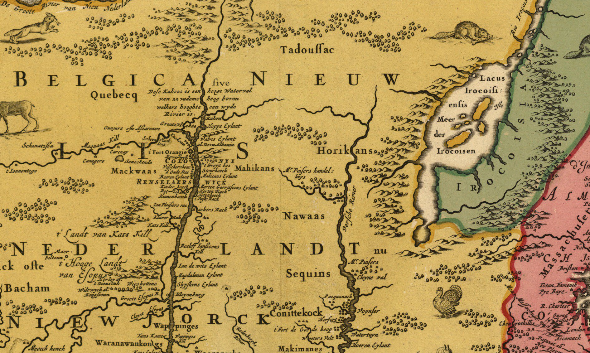
Maybe a less-consequential fail - but a stranger one - is that Tadoussac and Québec both appear West of the Adirondacks and Montreal. Québec appears twice, actually, though the smaller text is in the right place (more or less). The “over there somewhere” positioning makes it look like Visscher talked to a drunk Voyageur at some point.
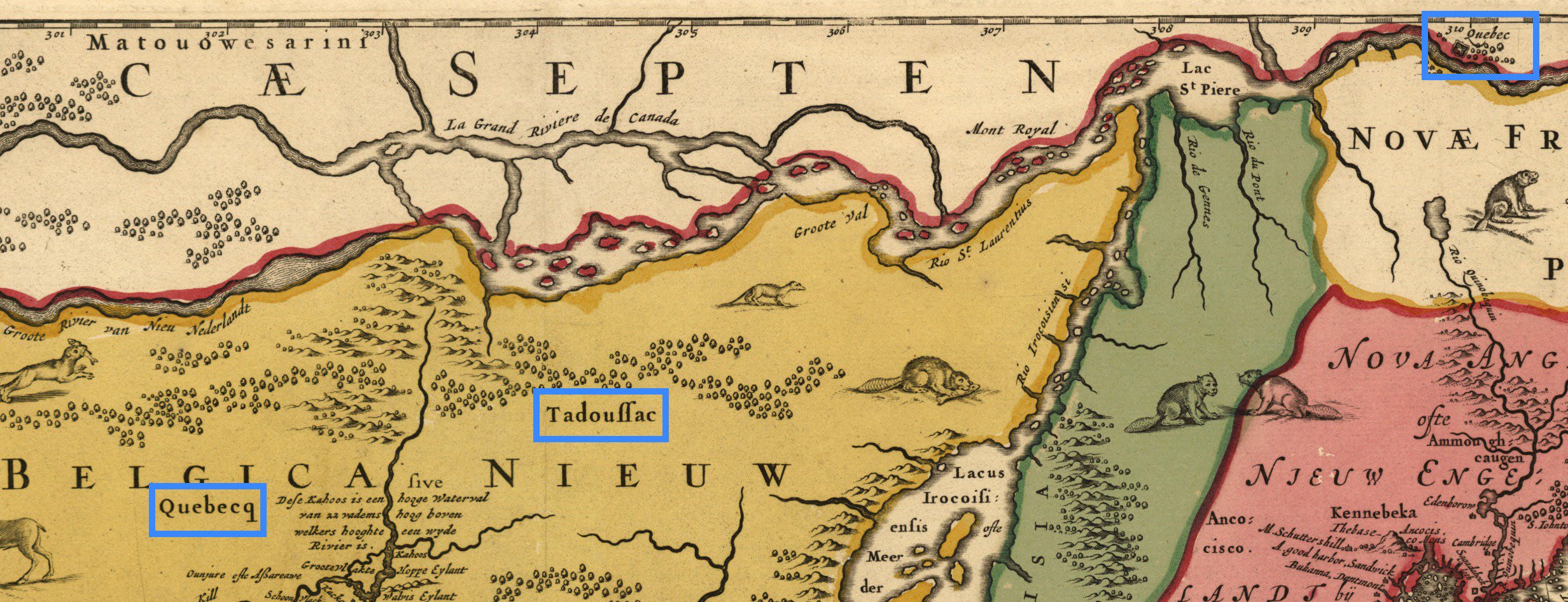
But strangely, the typeface and spelling is different between the two Québecs. One looks typeset and the other looks handwritten. And the double-Québec issue is reminiscent of a problem that plagues digital mapmakers: misprojected overlays.
Here’s a detail of Lake Champlain: the “Iroquois Sea”. Definitely got the presence of large islands right, plus the fact that there are plains on the Eastern shore and mountains on the Western.
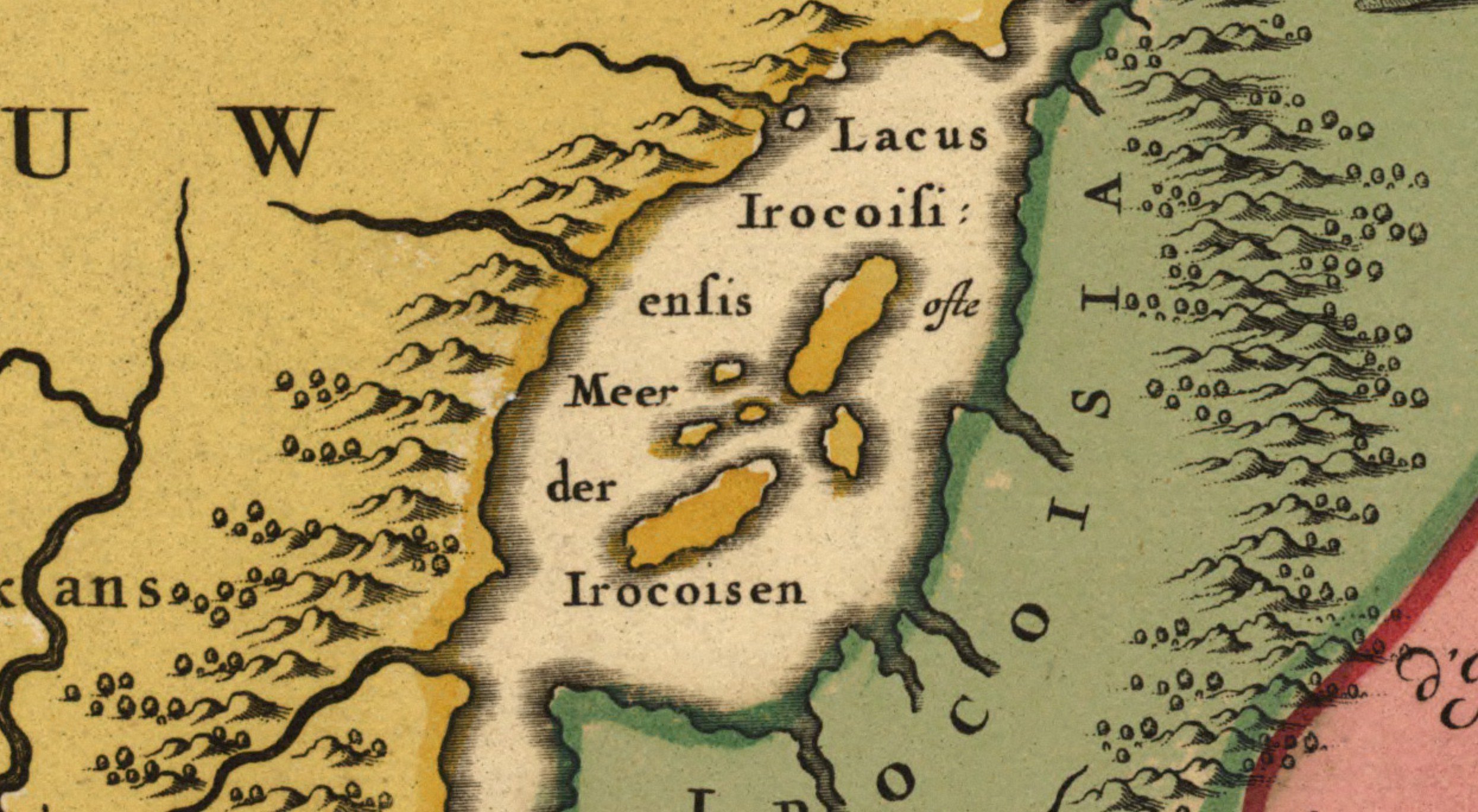
But it’s wrong in some familiar ways. It’s actually not inconceivable that Visscher ripped off the lake (and other stuff) wholesale from Samuel de Champlain’s 1612 map of New France, down to the squashed proportions and wrongly-diagonal orientation.
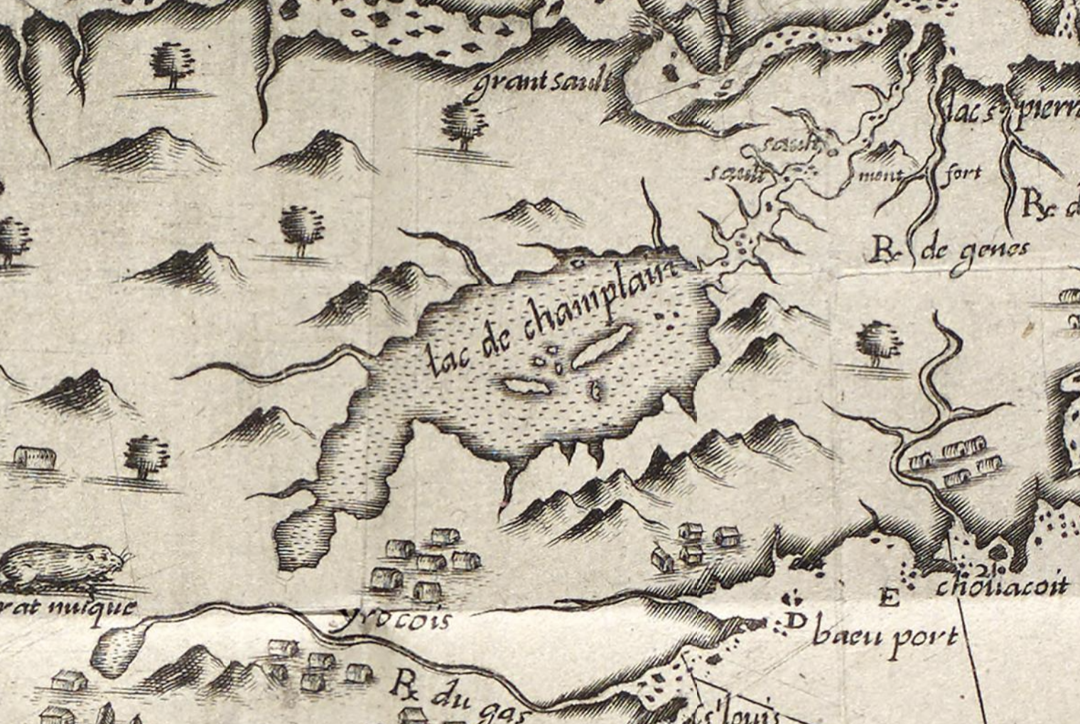
. . . and maybe down to the conflicting reports of the location of Québec.
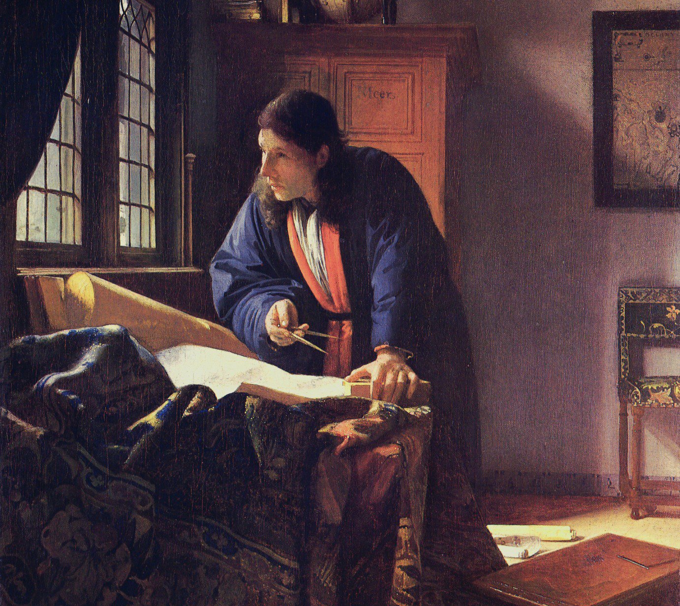
This causes me to realize how little I really know about cartography in this era. Did the mapmakers run with a combination of existing work and new reports from the field? Is Vermeer’s “Geographer” just winging it in the moment we observe him at work?
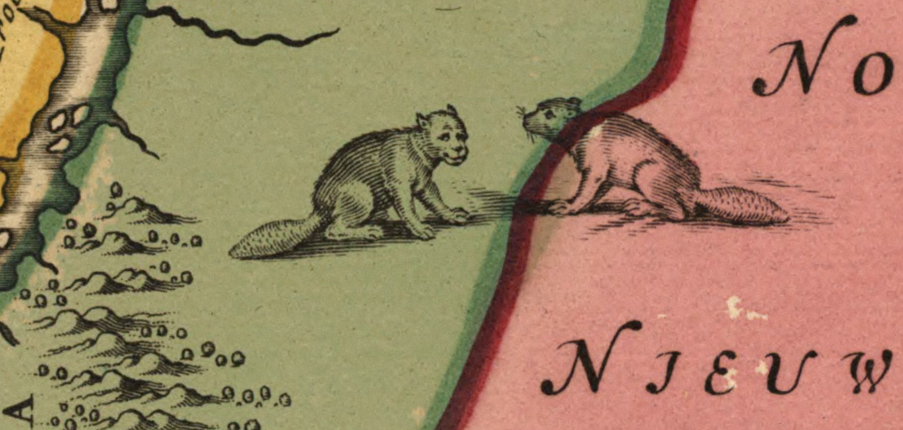
Questions beget more questions, and old maps are fun this way. I leave you with this smirking beaver-monkey-beast that’s been placed more or less directly on top of the forested region where I grew up.